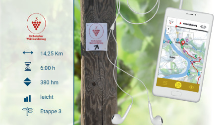

Supra-regional hiking routes
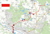

Red line: Niederwartha - Radebeul - Dippelsdorf - Bärnsdorf - Königsbrück
Distance: 28.1 km
Duration: 6:55 h
Difficulty: difficult
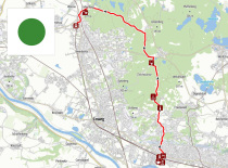

Green dot: Radebeul - Neuer Anbau - Niederau (railway station)
Distance: 14.4 km
Duration: 3:35 h
Difficulty: difficult
-
-
.svg)
Elevation profile of the Blue Dot Trail
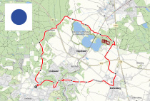
Blue dot: Friedewald circular route
Distance: 12.0 km
Duration: 2:55 h
Difficulty: moderate
-
-

Elevation profile of the Yellow Line Trail
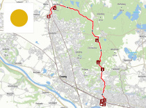
Yellow dot: Radebeul-Ost - Reichenberg - Moritzburg - Bärnsdorf
Distance: 13.4 km
Duration: 3:25 h
Difficulty: difficult
Further hiking recommendations: